Transcript
At six minutes past eight on a Friday morning, October twenty-eighth, nineteen eighty-three, two elk hunters from Boise were driving up a dirt road at about five miles an hour. They were in Arentson Gulch, in the foothills north of Mount Borah, the highest mountain in Idaho.
Right in front of them, the ground broke. A step opened up across the road. When it stopped, the road ahead stood about four and a half feet above the road they were on. They were on the side that went down. Geologists got to them that same day and wrote down what they saw.
Not far away, a couple from Challis, Bill and Lawana Knox, were hunting on foot. He was up on a hill, driving elk toward her, and she was waiting down by the power lines.
And up the road in the town of Challis, two kids were walking to school. We'll come back to that morning. First I want to tell you about the mountain. I live four miles from the bottom of it, and it turns out I've been getting it wrong.
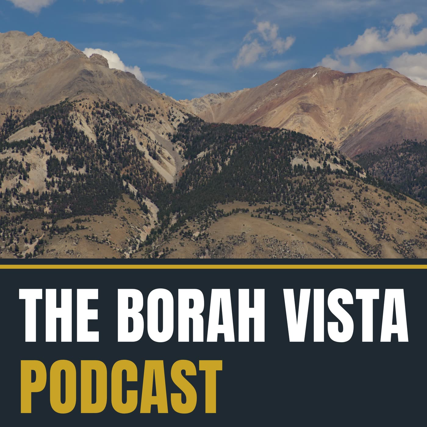
This is The Borah Vista Podcast, stories from the mountains of central Idaho. I'm Jason. A quick note before we go on. The voice you're hearing is an AI copy of my own voice, and this script was researched and written with AI tools, from the sources in the show notes. This one is about Mount Borah.
The Name
I'll start with the name, because it's the least interesting thing about the mountain. William Borah was a United States senator from Idaho. He served thirty-three years, from nineteen oh seven until he died in nineteen forty, and people called him the Lion of Idaho. He spent a lot of those years arguing that America should stay out of other countries' wars.
The mountain got his name while he was still in office. The Idaho papers were using it by nineteen twenty-nine. One account puts the government's official naming at nineteen thirty-four. Nothing I've found puts the senator on top of it. If you heard our last episode, you know the county I live in is named after a general who, as far as I can tell, never saw the place. We do this a lot around here.
That's the name. But it isn't what the government called the mountain first.
Station Beauty
Shoshone and Bannock people lived across this part of Idaho long before anybody wrote anything down about it. I went looking for what they called this mountain, and I didn't find it. That doesn't mean there was no name. It means I didn't find it.
The first climb anybody wrote down was in nineteen twelve. T. M. Bannon was a surveyor with the U.S. Geological Survey, the government agency that makes the maps. Surveyors built their maps by marking high points they could sight from far away. Each of those points got a name, and the survey's book calls this one Beauty. Station Beauty. Nobody I've read says why. Hold on to that word.
Here's the entry, word for word. On the highest peak in the Big Lost River Range, divide between the waters of Pahsimeroi and Big Lost River. About six miles northeast and visible from Dickey post office on the Mackay-Challis stage road. Can be reached only by a long, difficult climb afoot. Best route up Rock Creek from Dickey.
Then it lists what they left on top: a chiseled cross on solid rock, thirty-seven feet south, and a hole drilled for a marker under a large monument. Notice what the entry doesn't say. It says the highest peak in that range. It doesn't say the highest in Idaho.
Which One Is The Highest?
For years, the official maps and documents said the highest mountain in Idaho was a different one, Hyndman Peak, south of here in the Pioneer Mountains. Then, in nineteen twenty-nine, the Idaho Statesman newspaper ran this headline: Unnamed Peaks in Pahsimeroi Range Steal Hyndman's Glory. The Pahsimeroi is the valley on the far side of these mountains, and that's what the paper called the range.
A man from the state bureau of mines, Thomas Hite, told the paper that a federal surveyor named Lee Morrison had been working in Custer County. And then, this is the newspaper, word for word: suddenly the giant stuck its head into the field of vision at an elevation where no self respecting mountain, on the basis of known data, should be. Morrison ran his calculations and got twelve thousand six hundred feet. Hyndman, by the paper's figure, was twelve thousand and seventy-eight.
Custer County was not impressed. Cowles Andrus, who had represented the county in the state legislature, told the paper the county was at a loss to understand all the hot haste to climb the mountain, since perhaps a dozen parties had already done it. Here are his words. As long ago as twelve years, at least two survey parties ascended the mountain, and on top thereof one can find a survey monument giving the height figures very plainly. And he finished with this: it is strange there has been no correction of the statement about Hyndman. So the big discovery was news to everybody except the people who lived here.
Then a report came out of Arco. R. L. Sutcliffe was a former state senator, and a watermaster, the person who divides up the irrigation water. He said Borah was probably far from the tallest in that range. He said he knew of several peaks that looked higher, with deep snow on them while Borah was bare. He was wrong. Borah held. But he also said something I think is right. He said these mountains rise from a lofty plateau, so they don't give you the impression of height. The valley floor here is already more than a mile up. That's part of how the rest of the state missed its highest mountain.
Once people knew, they kept coming. In the late fifties and sixties, a man named Lyman Dye and his climbing club explored every side of it. A climber named Bob Boyles has been up it thirty times, by the count in Idaho's climbing guide, and that same guide says the mountain has been climbed in every month of the year. It also asks you not to hit golf balls off the summit, because people are climbing the faces below. Somebody had to write that down.
Winter is a different mountain. Thanksgiving weekend, nineteen seventy-seven, two brothers-in-law from Idaho Falls went up for an overnight climb. Guy Campbell was twenty-one. Vaughn Howard was twenty-two. More than three hundred people searched. They found the pickup at the base of the mountain, and a tent and sleeping bags at about eight thousand feet. They didn't find the men. The official search ended after three days. The families kept looking.
On August twenty-sixth of the next year, about sixty-two people went back up. Around noon, search and rescue found the two men with their climbing gear, at the bottom of an avalanche bowl on the northwest face, where they had been under about thirty feet of snow. A Custer County dispatcher told a reporter that people in the winter search had probably passed within thirty feet of where they lay.
The Ice Nobody Saw
Now I want to take you around to the north side of the mountain, the side I can't see from home, and the side the regular climbing route doesn't touch. There's a bowl up there, shaded almost completely by the mountain itself. A government map from nineteen sixty-six shows no glacier in it.
In nineteen seventy-four, a Boise State geology student named Bruce Otto hiked in for a class project. He wanted to see how much the snowfield in that bowl looked like a glacier. Under the snow, he found hard ice. The next summer he came back with his professor, Monte Wilson, and eight geology majors, and the Forest Service helicoptered their gear in. They measured ice more than two hundred feet thick, about thirty acres of it. And most of it was hidden, because the lower two-thirds was buried under rock, which may be why climbers overlooked it for decades.
Otto told a reporter years later, the first year I was there, the bergschrund was open. A bergschrund is the crack at the top, where moving ice pulls away from the rock wall. That one was more than a hundred and fifty feet deep. A crack like that is how you know the ice is moving, and moving ice is what makes it a glacier. For a while, people called it the Otto Glacier.
Then it seemed to die. Bob Boyles, the man with the thirty climbs, had seen that ice in the seventies. In September of nineteen ninety he went back, and he wrote this: the lower ice fields and the glacier were, for the most part, gone. By two thousand nine, geologists studying the West were reporting that Idaho had no glaciers left at all. Boyles wrote that he didn't know what it would take for the ice to come back, short of another ice age.
Then, in two thousand sixteen, a Forest Service employee and an intern went up and surveyed it. Their words: our survey confirmed the continued presence of the perennial ice mass originally identified in nineteen seventy-four, and concluded that the ice mass is indeed a glacier that continues to move under its own weight. One report says it's still more than two hundred and ten feet thick, and creeping a couple of feet a year or more. It had shrunk, but it had never left.
In February of twenty twenty-one, the U.S. Board on Geographic Names made it official, and named it Borah Glacier. Not the Otto Glacier, because features generally aren't named for living people, and Bruce Otto was alive to be quoted about it. So you'll hear that this is the only glacier in Idaho. It's the only one with paperwork. Otto says there's glacial ice under the rocks in the White Clouds too, and a man from Boise named Collin Sloan, who pushed to get this one recognized, says he's found another that he won't tell anybody about.
What It Stands In
Here's what still gets me about this mountain. It's right there. Highway 93 is the main road through this valley, and you're literally driving at the base of it. At the closest point, the summit of the highest mountain in Idaho is about four and a half miles from your windshield. And just to the south, Mount Idaho, twelve thousand and sixty-five feet, seems to butt right up against the highway.
All of this is the Lost River Range. Idaho has nine peaks over twelve thousand feet, and seven of them are in this one range. A climbing writer named Tom Lopez, back in nineteen eighty-two, called it bad crumbly rock. From the road, you'd never know. The other peaks are so huge and so amazing.
We drove Doublespring Pass, the gravel road that goes up and over the range just north of Borah, and came around the back. We live on the west side, so that's the side we know. It's so different back there. When we went through, there was more snow on the east side than we ever see from home. On the other side is the Pahsimeroi Valley, the one those old newspapers named the whole range after.
And the river that runs through our valley is the Big Lost, and the name is honest. Most years, irrigation takes so much of it that it doesn't flow past the town of Arco. Whatever gets through sinks into the desert and goes underground, into the aquifer under the Snake River Plain. Water from that aquifer comes out of the canyon walls down by Twin Falls, more than a hundred miles from here.
Back To That Morning
So. Eight oh six, that Friday morning. Near Mackay, Holly and Bill Seefried were asleep at their ranch. She told a reporter it was a rumbling like wind, and then the bed started jumping. Stones fell out of walls three feet thick, and water spurted from broken pipes. Her words, twenty-five years later: we thought it was just us. It wasn't. In Mackay, Main Street was buried in brick. Eight buildings were condemned, and the high school came down that fall. Jars of fruit and vegetables from the harvest were smashed on the floor. Word got around that the dam above town might have broken, and people camped above it for days, until the Army Corps of Engineers said it was sound. In all of Mackay, one person was hurt.
Out on the valley floor, near a place called Chilly Buttes, water shot out of the ground, carrying sand with it. It kept going for minutes after the shaking stopped, and it left about thirty giant craters of sand. Over the next few months, the U.S. Geological Survey figures, nearly a cubic kilometer of extra water came out of the ground around here. That's about twenty times what Mackay Reservoir holds. A hundred and fifty miles away in Yellowstone, Old Faithful went from erupting every sixty-nine minutes to every seventy-seven. At the federal nuclear lab, southeast of here, one reactor shut itself off, and another was switched off by hand.
Up near Challis, J. D. Bennetts was six, brushing his teeth, and his mother, JoAnn, had just caught a mouse that had been bothering her for weeks. She was about to flush it. The house started making a noise, he says, like birds landing on the shingles of the roof. It went on for about forty-five seconds. And then, he told the Post Register, she snapped right back to normal. The kids were going to miss the bus. So there she is, barking at him to find his shoes, pointing at him with the mousetrap still in her hand, and the mouse's tail is wagging in his face.
A little later, the Bennetts kids got on the school bus, all excited, and asked everybody about the earthquake. Nobody believed them. The bus had been moving, and nobody on it felt a thing. In town, an eight-foot boulder had rolled down the hill and gone through Harry and Mona James's house. Another one stopped a few feet short of a house, and the family painted it like a pumpkin, because it was almost Halloween.
At the top of Main Street in Challis stood an old limestone building everybody called the rock building. It was J.P.'s Bargain Barn. Two kids were walking past it on their way to school. Two other kids who usually walked with them hadn't caught up yet.
Alan Hardman ran a general store across the street, and a reporter took down what he saw. The girl started to cross the street. The boy hollered at her to get back because a car was coming, and that's when it came down.
Men ran from up and down Main Street, one of them Bill Millick from the bank, and they pulled the rubble off. They couldn't save them.
Travis Franck was six. Tara Leaton was seven.
The elementary school principal had worked with both of them, and he said that for days many of the kids were afraid to go into the school. Travis was in J. D. Bennetts's class. Forty years later, Bennetts pointed out that the old high school was badly damaged, and it would have been full of students later that morning. Challis had built a new one that year, and the students were moving in the very next week. If it had been an hour later or a year earlier, he said, the impact would have been so much greater. And he said this: it's kind of like where were you when Kennedy was assassinated. A lot of people have their earthquake story.
Eight Inches
Here's the part I didn't expect. I told you this mountain grew. I've said it a lot. In my own film about climbing it, I said an earthquake made it a foot taller in thirty seconds. Everybody says something like that. The state's roadside sign says six inches. A newspaper said a foot and a half. A geologist's blog says nearly a meter.
So I went and read the actual measurement. The government had surveyed a line of elevations across this valley before the earthquake, so afterward, they surveyed the same line again. The top of the range near Borah came up about eight inches. Eight inches. The valley dropped as much as four feet. The fresh step along the base of the mountains, the one the hunters watched, is up to nine feet high in places. So most of what looks like the mountain going up is the valley going down.
And that small number turned out to be a big deal. The two scientists who worked it out wrote that nobody had ever proved before that the mountains actually go up in this kind of earthquake. It took this one. I've been saying it wrong, and I've also been underselling it.
It wasn't finished, either. The next evening, about five thirty, a geologist named Frances Boler was standing about fifty feet from the new step, just off the Doublespring Pass Road, when an aftershock hit. She looked at it, and the two sides of the break were sliding back and forth past each other, by about a foot and a half. Her words: I saw three turning points, looked away, looked back and saw one more. Then the shaking stopped, and so did the ground.
Those same scientists say this fault has moved about two miles in the last four to seven million years. That's not one big event. It's mornings like that one, and one report puts the last one on this stretch about fifteen thousand years earlier. The valley I live in has thousands of feet of rubble in it, filling up the drop. So a mountain like this doesn't get built. It gets left behind, a few inches at a time, while the ground around it falls away.
Go See It
You can go see that step, and you don't have to climb anything. Take Highway 93 north from Mackay to the Doublespring Pass Road, then go about two and a half miles up the gravel. There's a parking lot, an outhouse, some signs, and a fence. And there it is, a raw bank of dirt running along the foot of the mountains. It's been sitting there for forty-three years.
If you want to climb the mountain, the turnoff is about twenty miles north of Mackay, and about thirty-three south of Challis, with a brown sign. Then it's about three miles of dirt to the trailhead, fine for most cars in good weather. Expect snow to close it for much of the cold part of the year. There's a small campground at the bottom with no water. The climb is about four miles, one way, and more than five thousand feet up. In that last stretch you need your hands, and there's real air on both sides.
One warning. You may hear there's a shortcut around the hard part. A deputy who has gone out on rescues for climbers lost on that shortcut says it doesn't save any time. One group that lost its way ended up headed down toward Rock Creek, the way Bannon went up in nineteen twelve, and that's a very long way from your car. Everything you need to plan a trip is in our guide, at borah vista dot com slash guide.
My Climb
Now I'll tell you how I did. This past July, I pulled in at seven twenty-four in the morning. The lot was full, so I found a bush to park in. The guys who had delivered our building the day before were going up too, so there was some peer pressure. On camera, at the bottom, I said I don't know if I'm getting to the top, not making any promises, my bag's very heavy. Then I said: excuses already.
It starts in the trees, and it goes straight up. About an hour and twenty minutes in, at around ten thousand two hundred feet, I turned the camera on and said this. It's the hardest thing I've ever done. No question.
Two summers earlier, a runner named Jackson Cole went from that parking lot to the summit and back to his car in one hour, fifty-three minutes. Round trip. I try not to think about that.
But a few minutes after that wall, you come out of the trees and onto the ridge. It's cooler. You can see everything. I felt euphoric, and that's the word I used. And I said what I'd still tell anybody. I don't know if I'm getting to the top, but it's definitely worth just getting to there. Later, looking back up at it from below, I said, if you can make it there, it's another world.
I kept going. At ten past ten I was at about eleven thousand three hundred and sixty-five feet, just below the famous part, a bare spine of rock called Chicken Out Ridge. Nobody I've read knows who named it. I looked at it, and I told the camera, Borah is a beast. And I turned around. I want to be clear about why. It wasn't the fear, it was the strength. I didn't have it.
Going down was worse. Both legs cramped, and I made a confession to the camera. If there was a zip line from the top down to the bottom, I would have gone to the top. Back at the car, five hours and twenty-nine minutes after I started, my legs were jello. The guy who delivered our building got to the top. I did not.
On the way down I said one more thing, and I still think it's true. When I'm in a city, the whole energy is money and trying to get ahead. You come out to a place like this, and it's so vast, and you're so small, there's just no competition. You're in a different mode.
Four Miles From The Base
There's one clip from that day I keep going back to. At ten thousand six hundred and eighty-six feet, I stopped and looked down, and I found it. A white roof, way down in the valley. Our place. I held up the camera and said, right in the middle of my screen, you can see that white roof. Four miles from the base of the mountain, on the side that went down.
Now here's the same thing from the other end. Our land is at about sixty-two hundred feet. The top of Borah is about a mile and a quarter above that. So it'll be raining at our place. And then the clouds dissipate, and all you see is white. Everything above seven or eight thousand feet, depending on the temperature, just goes white. The clouds seem to form around it. It's a different season up there, right over your head.
A senator got the name. But the first name I can find the government writing down for this mountain is Beauty. I look up at it from under the rain, and I think whoever wrote that had it right.
This has been The Borah Vista Podcast. I'm Jason. Thanks for listening.
Sources
- USGS Open-File Report 85-290-A: Workshop on the Borah Peak, Idaho, Earthquake (1985)
- UPI, October 29, 1983
- Ensign, January 1984
- Claims Journal, October 22, 2008
- Idaho Office of Emergency Management
- Idaho Historical Marker 356
- Pelton, Meissner and Smith, 1984, abstract
- Roc Doc Travel: Borah Peak
- USGS triangulation entry, station Beauty, 1912
- Tom Lopez, Idaho: A Climbing Guide
- Bob Boyles, The End of the Last Idaho Ice Age
- Post Register, in the Spokesman-Review, March 18, 2021
- Rick Just, Speaking of Idaho
- Portland State University: Glaciers of Idaho
- United States Senate: William Borah
- Jason Leue's own climb footage, July 25, 2026
- Post Register, October 27, 2023
- Idaho Mountain Express, March 9, 2021
- Idaho Statesman, 1929, on Idaho: A Climbing Guide
- East Idaho News, December 15, 2025
- Fastest Known Time: Mt. Borah
- USGS: the Big Lost River